You are here Home » Trips a-la-carte » Destinations » Thailand » Geography
Thailand - Geography
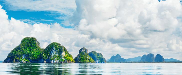
Thailand shares borders with Malaysia, Myanmar (Burma), Laos and Cambodia. The country's east coast borders the Gulf of Thailand and the west coast abuts the Andaman Sea. The country is divided into four main zones: the fertile, central plains of the Chao Phraya River; the poorer region of the 300m (985ft) high northeast plateau; the fertile valley and mountains of Northern Thailand; and the rainforested southern peninsula. The highest peak is the 2596m (8512ft) Doi Inthanon in Chiang Mai province.
Top Destinations


Top Destinations


General Information
Official name
Kingdom of Thailand
Capital
Bangkok (Krung Thep – city of angels)
Area
514 000 sq km
Population:
64 265 276
Time Zone
GMT/UTC +7 ()
Currency
bath (THB) =100 stangs
Official language
thai
Neighbouring countries
Barma / Myanmar, Cambodia, Laos, Malaysia
Highest mountain
Doi Inthanton - 2595 m n. m
Ebb tide
Gulf of Thailand - 0 m. n. m.
Longest river
Mekong (in the country 900 km)
Biggest city
Bangkok (6.250.000 people)
Landing place
Bangkok, Laem Chabang, Pattani, Phuket, Sattahip, Si Racha, Songkhla
People
75% Thai, 11% Chinese, 3.5% Malay; also Mon, Khmer, Phuan and Karen minorities
Religion
95% Buddhist, 4% Muslim